For every project the Friendly Streets Initiative carries out extensive data collection and analysis. We collect opinions expressed about street concepts and maps, we survey residents and business (paper and online), carry out demographic analyses, research claims about particular streets made by public and other agencies, examine and measure street conditions, take field notes at events, and do interviews and focus group research. Our primary deliverable is a report for the neighborhood(s) that can be the basis of creating a consensus vision and partnering with City planners and decision-makers toward the achievement of change.
OPINIONS ON GALLERY CONCEPTS AND MAPS
FSI displays large images of concepts and street maps to excite the imagination as to what street can have or be. We take ideas from all over the world, and remain attentive to new concepts and innovative thinking globally. We invite event-goers to indicate the ideas they like (or don’t) and record that data. To see this in action, click here.
SURVEYS
FSI co-authors surveys of residents and businesses in the project area with the goal of getting as wide array of opinions as possible on the possible problems and solutions for public spaces, typically streets. Examples of our surveys can be found in the Appendixes of our Reports (see below).
DEMOGRAPHIC ANALYSIS OF NEIGHBORHOODS
Among the first tasks of a FSI project is to do a demographic analysis of the neighborhood, which serves the FSI in better understanding the neighborhood, as well as mark a reference for determining how representative FSI events are.
MUNICIPAL AND OTHER AGENCY REFERENCES TO STREETS
FSI has found that when public and private agencies make claims about a particular street, they serve three uses: To know how others see the potential transformation of the street; to possibly partner with those agencies; or to use claims as leverage for moving toward actual implementation. Among the first tasks of any FSI project is to research where the project in question appears in other plans.
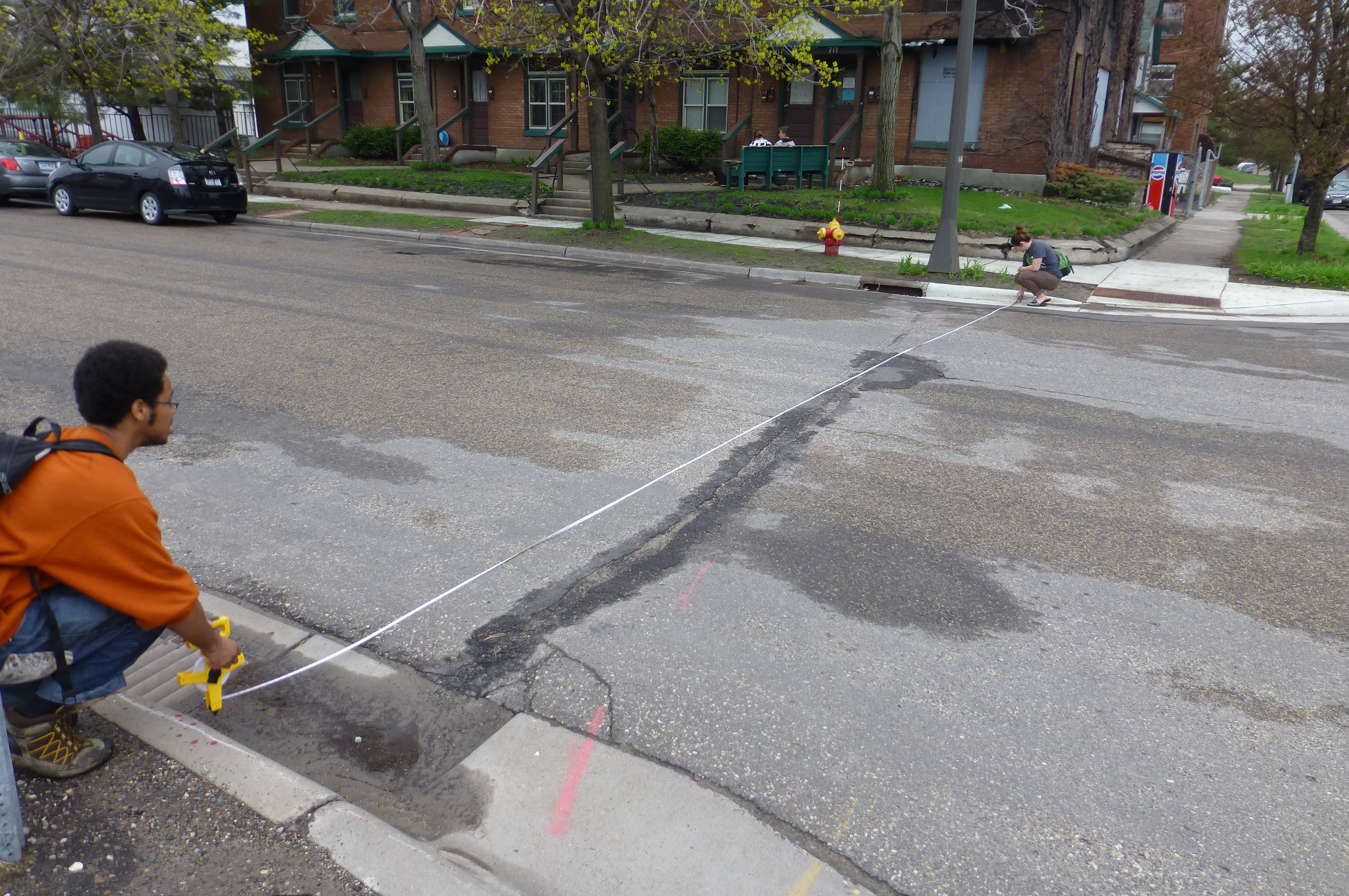
RESEARCH ON STREET CONDITIONS
The physical design of the streets, sidewalks and boulevards, as well as neighborhood land-uses, traffic usage data, and jurisdictional authority, are important for understanding the possibilities and limits of the transformation of streets. FSI measures each street, sidewalk, and boulevard and curb radii; we acquire data on traffic patterns; and we do parking studies.
INTERVIEWS AND FOCUS GROUPS
Members of the FSI team are trained in social science research methodologies with extensive experience with interviews and focus groups. Such methods are deployed according to the needs of a project.
FIELD RESEARCH
At each event we take field notes as another data source for understanding how neighbors (residents and businesses) experience and imagine the possibilities of a street transformation.
REPORTS
After the first phase of each collaborative project we create a report that brings together data collected from surveys, gallery of image votes, map post-it comments, event head counts, and field notes. This goes into a report that community members can use, with assistance from Friendly Streets, to take concrete action steps towards working with the city and advocating for the ideas the people in the neighborhood value most.
DPIA and FSI Collaboration Report
FSI Pelham Boulevard Parking Study for DPIA
FSI Victoria Street Bridge Report